The Trail:
The full trail is pretty grueling on a mountain bike. It's 12 miles long with lots of big ups and downs, and comes out several miles to the West along I-80. The full ride is not recommended! Lloyd recommends riding out to the high point of the trail, which provides nice scenery and a nice downhill ride back the way you came, for about a 3-mile round trip. Going further would involve major uphill backtracking. Better to have a nice, light ride after Downieville. Here's a trail map from "the Fish."
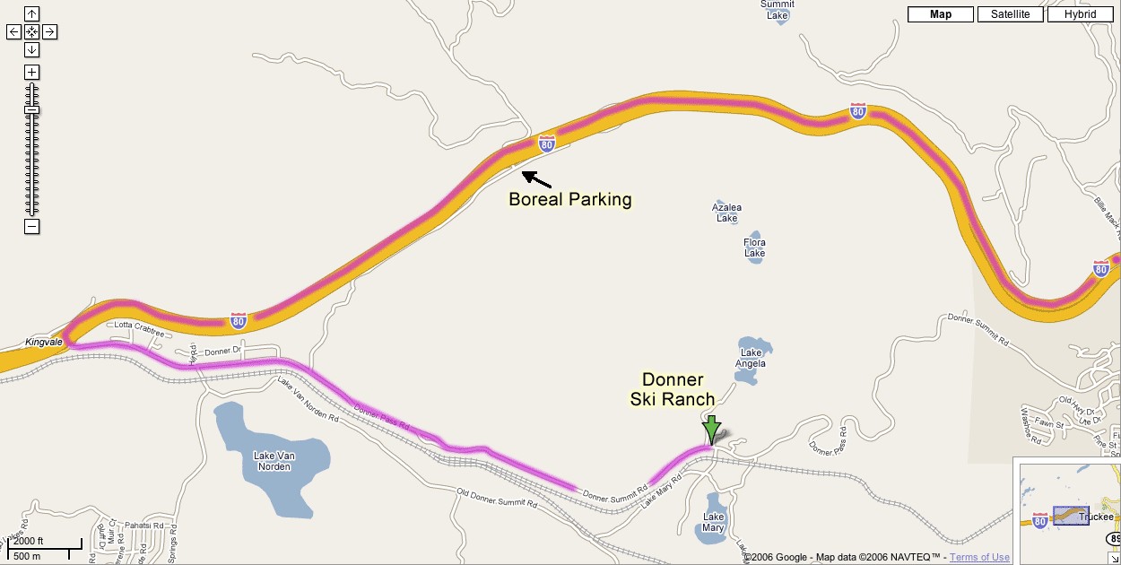
Donner Ski Ranch:
From Truckee or from the ride above, take I-80 west to the Soda Springs/Norden exit.
Turn left at the stop sign and follow the road for 3.5 miles. Donner Ski Ranch is on the left. Their Web site
(Even more) scenic route back toward Truckee:
If you didn't think the scenery along I-80 to the Donner Summit was interesting enough, try a different view by turning left when you pull out of the Donner Ski Ranch parking lot. Follow Donner Summit/Donner Pass Road over the nearby summit. Optionally pull off at the viewpoint near the bridge there. Then head down toward Donner Lake. Follow the road along the left side of the lake, and Donner Pass Road will lead you back up to I-80.
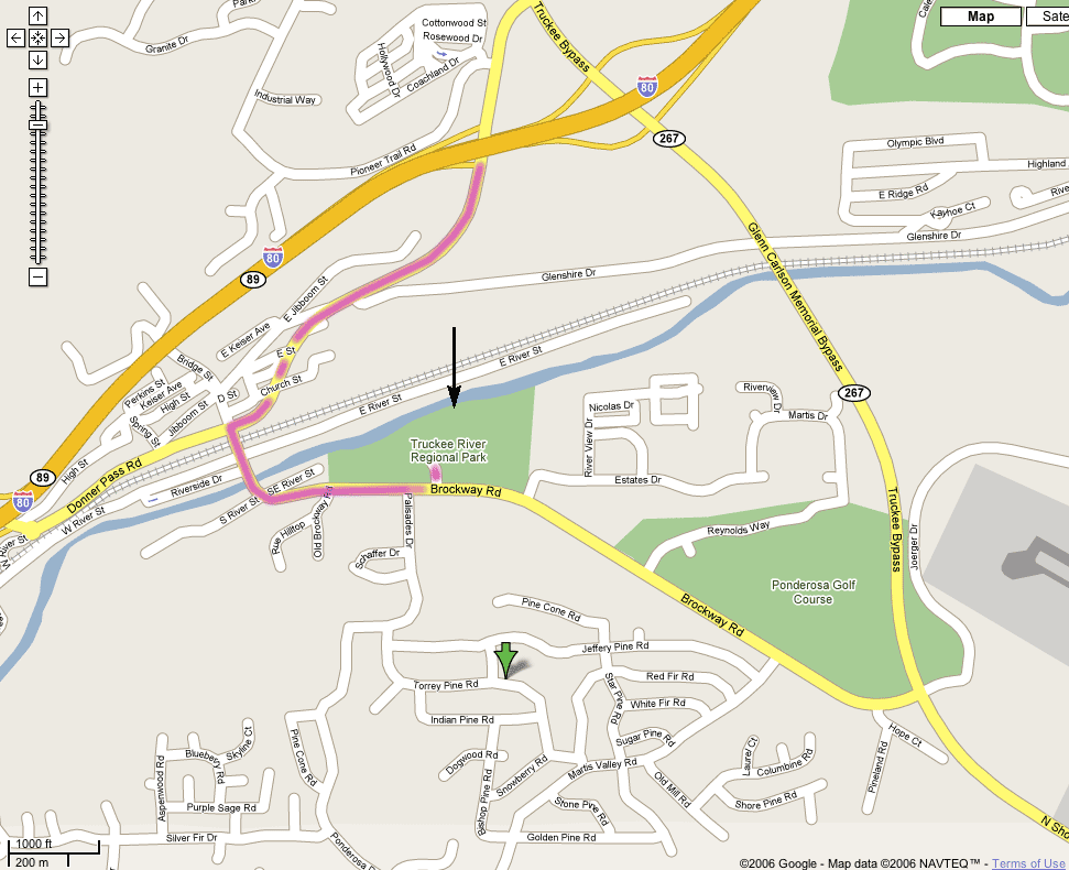
Truckee River Regional Park
This park is right in the middle of Truckee, very close to Cabin 1 and some of the hotels. The black arrow on the map below shows roughly where our picnic area will be within the park (right down by the river). The green area shows how close this is to Cabin 1 (this is the same map image with different route shown).